|
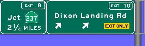
| Exit
10 |
 South South |
Dixon Landing Road straddles Alameda
and Santa Clara counties. The Milpitas landfill is located west
of the freeway while a mix of residential and commercial areas
are located east of the freeway. This is also a good alternate
route to the McCarthy Ranch shopping center. |
|
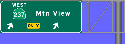
| Exit
8C |
South |
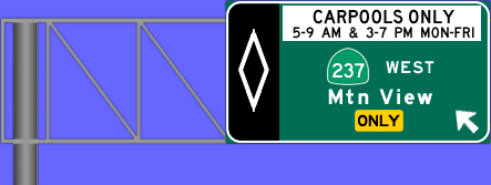
Westbound Hwy 237 passes through north
San Jose, Santa Clara and Sunnyvale before ending in Mountain
View. Because of extensive commercial development along this
corridor, the freeway is very congested during commute hours.
A carpool-to-carpool ramp was built connecting
south Interstate 880 to west Highway 237. This ramp can be used
by anyone outside of commute hours. |
|
| Exit
8B |
South |
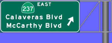
Highway 237 east continues as Calaveras
Blvd through the city of Milpitas before ending at Interstate
680. McCarthy Blvd and the McCarthy Ranch shopping center are
also accessible from this exit. |
|
| Exit
8A |
South |
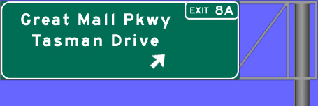
Great Mall Pkwy heads east to the Great
Mall of the Bay Area. It used to be a Ford assembly plant before
it was closed and transformed into a shopping mall. After crossing
Montague Expwy, it becomes Capitol Avenue.
Tasman Drive heads west to a number of
commercial developments and the Great America theme park. The
VTA has a light rail line running in the median of from Fair
Oaks Ave in Sunnyvale to east San Jose. |
 |
| Exit
7 |
South |
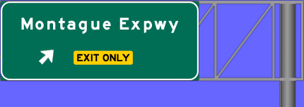
Montague Expwy is part of the county's
expressway system with a number to tech companies located along
the corridor. South of U.S. 101, Montague Expwy becomes San Tomas
Expwy. |
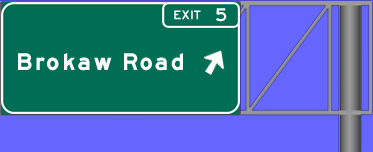 |
| Exit
5 |
South |
Westbound Brokaw Road becomes Airport
Pkwy after crossing First Street and heads into the Mineta San
Jose International Airport. This section of Interstate 880 was
widened to 6 lanes from 4 in 2003. This relieved one of worst
bottlenecks in the region. There are plans to add an HOV lane
from Hwy 237 to U.S. 101. |
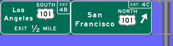 |
| Exit
4C |
South |
U.S. 101 heads north to San Francisco and
beyond to the Oregon and Washington coast.
Although it's signed like a direct
connector to U.S. 101 north, it isn't. The road the ramp leads
to is Old Bayshore Hwy and to get to U.S. 101, you have to make
a right at the signal (Old Bayshore) and then make a left onto
the U.S. 101 north on-ramp located about a quarter mile from this
exit. |
 |
| Exit
4B |
South |
U.S. 101 is one of two main highways linking
Los Angeles and San Francisco. U.S. 101 follows the California
coastline on its journey to southern California.
This ramp is a direct connector to U.S.
101 south but it's an old style cloverleaf ramp that causes merging
problems and extensive backups on Interstate 880. |
 |
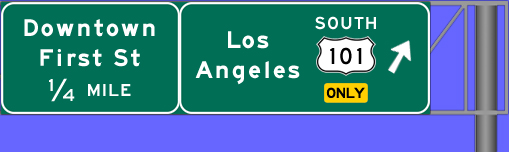
| Exit
4A |
South |
First Street links downtown San Jose to
the mostly commercial region of north San Jose. It also has a VTA
light rail line running almost its entire length. Because of the
light rail, First Street is a pretty narrow 4-lane or 2-lane street. |
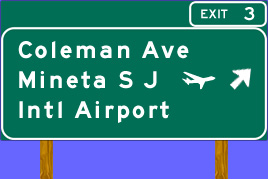 |
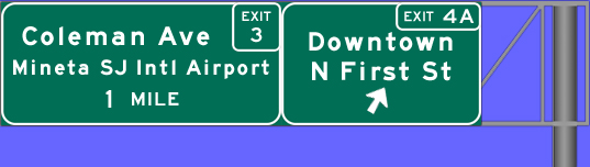
| Exit
3 |
South |
The Coleman Avenue exit is the primary
way to get to the Mineta San Jose International Airport. Southbound
Coleman heads into downtown San Jose. Northbound Coleman heads
into Santa Clara.
Due to low-flying aircraft landing at the
near-by airport, the exit sign is not an overhead. |
 |
| Exit
2 |
South |
The Alameda is the southern extension of
El Camino Real. It begins near Santa Clara University and runs
all the way to downtown San Jose. Hwy 82 extends north to Daly
City via El Camino Real and south to south San Jose via Monterey
Hwy. |
 |
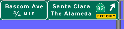
| Exit
1D |
North |
Bascom Avenue is a major north-south road
that connects Los Gatos and Campbell to San Jose and Santa Clara.
San Jose City College is located to the south while Santa Clara
University is located to the north. |
 |
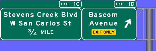
| Exit
1C |
North |
Due to the proximity of the Valley Fair
mall and Santana Row to this exit, this ramp is often backed up
during the day, 7 days a week. Stevens Creek Blvd becomes San Carlos
St at Bascom Avenue and it's a major east-west road between Cupertino
and San Jose. |
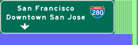 |
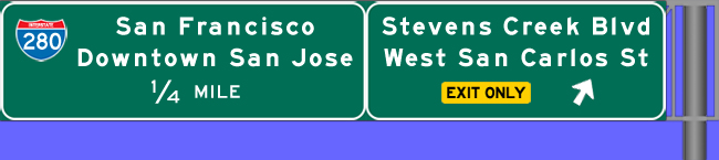
| Exit
1B |
North |
Interstate 280 is a more scenic freeway
to San Francisco and passes through Santa Clara and Cupertino before
heading into the foothills of the Santa Cruz Mountains. South Interstate
280 heads into downtown San Jose.
|
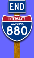 |
Interstate
880 becomes State Highway 17 after crossing Interstate 280 and
heads to Santa Cruz. This transition is technically Exit 1A. |